


ROSENDALE - T 1 Voting District, Fond du Lac County, Wisconsin
About
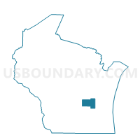
Outline

Summary
| Unique Area Identifier | 693723 |
| Name | ROSENDALE - T 1 Voting District |
| County | Fond du Lac County |
| State | Wisconsin |
| Area (square miles) | 35.56 |
| Land Area (square miles) | 35.15 |
| Water Area (square miles) | 0.40 |
| % of Land Area | 98.87 |
| % of Water Area | 1.13 |
| Latitude of the Internal Point | 43.84904200 |
| Longtitude of the Internal Point | -88.70249250 |
Maps


Graphs
Select a template below for downloading or customizing gragh for ROSENDALE - T 1 Voting District, Fond du Lac County, Wisconsin


Neighbors
Neighoring Voting District (by Name) Neighboring Voting District on the Map
- ELDORADO - T 1 Voting District, Fond du Lac County, WI
- ELDORADO - T 2 Voting District, Fond du Lac County, WI
- LAMARTINE - T 2 Voting District, Fond du Lac County, WI
- METOMEN - T 1 Voting District, Fond du Lac County, WI
- NEKIMI - T 2 Voting District, Winnebago County, WI
- RIPON - T 1 Voting District, Fond du Lac County, WI
- RIPON - T 2 Voting District, Fond du Lac County, WI
- Rosendale - V 1 Voting District, Fond du Lac County, WI
- SPRINGVALE - T 1 Voting District, Fond du Lac County, WI
- UTICA - T 1 Voting District, Winnebago County, WI
- UTICA - T 2 Voting District, Winnebago County, WI
Top 10 Neighboring County Subdivision (by Population) Neighboring County Subdivision on the Map
- Lamartine town, Fond du Lac County, WI (1,737)
- Eldorado town, Fond du Lac County, WI (1,462)
- Nekimi town, Winnebago County, WI (1,429)
- Ripon town, Fond du Lac County, WI (1,400)
- Utica town, Winnebago County, WI (1,299)
- Rosendale village, Fond du Lac County, WI (1,063)
- Metomen town, Fond du Lac County, WI (741)
- Springvale town, Fond du Lac County, WI (707)
- Rosendale town, Fond du Lac County, WI (695)
Top 10 Neighboring Place (by Population) Neighboring Place on the Map
Top 10 Neighboring Unified School District (by Population) Neighboring Unified School District on the Map
- Oshkosh Area School District, WI (79,472)
- Ripon Area School District, WI (10,705)
- Rosendale-Brandon School District, WI (5,524)
Top 10 Neighboring State Legislative District Lower Chamber (by Population) Neighboring State Legislative District Lower Chamber on the Map
- Assembly District 53, WI (59,677)
- Assembly District 52, WI (56,377)
- Assembly District 41, WI (55,581)
Top 10 Neighboring State Legislative District Upper Chamber (by Population) Neighboring State Legislative District Upper Chamber on the Map
Top 10 Neighboring 111th Congressional District (by Population) Neighboring 111th Congressional District on the Map
Top 10 Neighboring Census Tract (by Population) Neighboring Census Tract on the Map
- Census Tract 20, Winnebago County, WI (6,932)
- Census Tract 414, Fond du Lac County, WI (5,893)
- Census Tract 19, Winnebago County, WI (5,016)
- Census Tract 417, Fond du Lac County, WI (3,986)
- Census Tract 415, Fond du Lac County, WI (3,096)
Top 10 Neighboring 5-Digit ZIP Code Tabulation Area (by Population) Neighboring 5-Digit ZIP Code Tabulation Area on the Map
- 54904, WI (20,623)
- 54971, WI (10,827)
- 53919, WI (2,629)
- 54974, WI (1,581)
- 54932, WI (1,185)
- 54964, WI (1,022)